
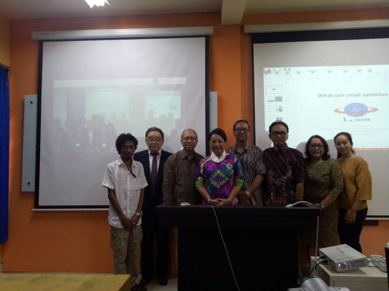
Unud and Yamaguchi University Held 'International Symposium on Establishment of the Southeast Asia Research and Education Center for Disaster Reduction and Environmental Monitoring using Satelite Remote Sensing'

Denpasar - Udayana University in collaboration with Yamaguchi University, Japan held International Symposium on Establishment of the Southeast Asia Research and Education Center for Disaster Reduction and Environmental Monitoring using Satellite Remote Sensing on Tuesday (17/10/2017) at GDLN Unud Campus Sudirman Denpasar . The symposium was conducted by Center for Remote Sensing and Ocean Sciences (CReSOS) Unud in collaboration with Yamaguchi University's Center for Research and Application of Satellite Remote Sensing (CRAS) via Teleconference.
Prof. Mengu Cho, Director of the Laboratory of Spacecraft Environment Interaction Engineering, Kyushu Institute of Technology was presented as a Keynote Speaker, with the topic "What Can Small Satellites Can Do?". In addition there were also some other presentations about research that included the montoring with satellite and GPS.
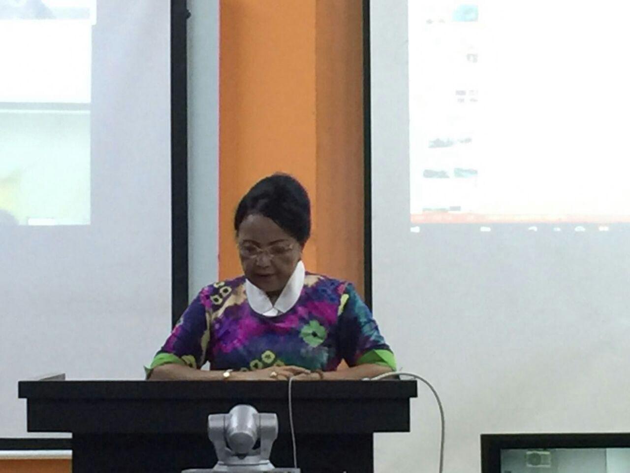
(Rector Unud, Prof. A.A. Raka Sudewi when delivering speech)
Rector of Unud, Prof. A A. Raka Sudewi conveyed that Udayana University has done a lot of international cooperation, in the form of seminar, symposium, conference, FGD, international class, and various other activities with many institutions in the world and one of them the cooperation which is actively held by both parties with Yamaguchi University, Japan.
This symposium was urgently needed and coincidentally carried out simultaneously with the possibility of a disaster that threatens Bali, namely the possibility of the eruption of Mount Agung. As is known, Mount Agung last erupted in 1963 which became one of the hardest and most terrible history in the history of Indonesia that occurred on February 18, 1963. Currently, according to a report of Local Authority, last 3 weeks, the condition of Mount Agung status is in alert, thousands records of earthquakes and seismic activity are still very high. Mount Agung has been observed that is spewing white smoke and more than 140,000 Balinese have been evacuated and experts have warned that the eruption could happen anytime.
The symposium was expected to be an early mitigation effort against disaster threats that can be formulated through remote sensing by using the satellites. Application of remote sensing satellite technology is required to predict hazard areas and take precautions. Through this opportunity, Rector hopes that CReSOS Unud can contribute more to the development of academic and research fields, especially in the field of remote sensing and marine science, and through the development of double degree programs, exchange programs for Indonesian and Japanese students, research and international publications. (HM)
(International Symposium on Establishment of the Southeast Asia Research and Education Center for Disaster Reduction and Environmental Monitoring using Satellite Remote Sensing)


